


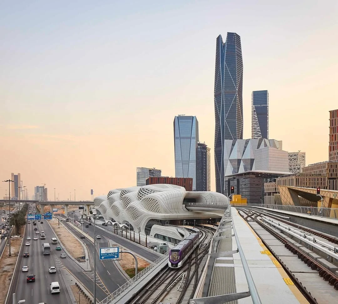
Spanning an impressive 176 kilometres, this expansive urban transport system, which is a cornerstone of the broader King Abdulaziz Project for Riyadh Public Transport, operates across six integrated lines and 85 stations.
The Riyadh Metro was developed, designed and implemented to reduce the chronic traffic congestion in the capital, whilst supporting rapid urban and economic development, and enhance overall accessibility for the city's growing population. This significant achievement by the Royal Commission for Riyadh City highlights the Kingdom’s commitment to building smart, sustainable infrastructure, directly supporting the goals of Saudi Vision 2030 to diversify the economy and elevate the quality of life in Riyadh.
You Might Also Like: 100 million riders have used Riyadh Metro in just 9 months
Award-winning Network Scale and Coverage
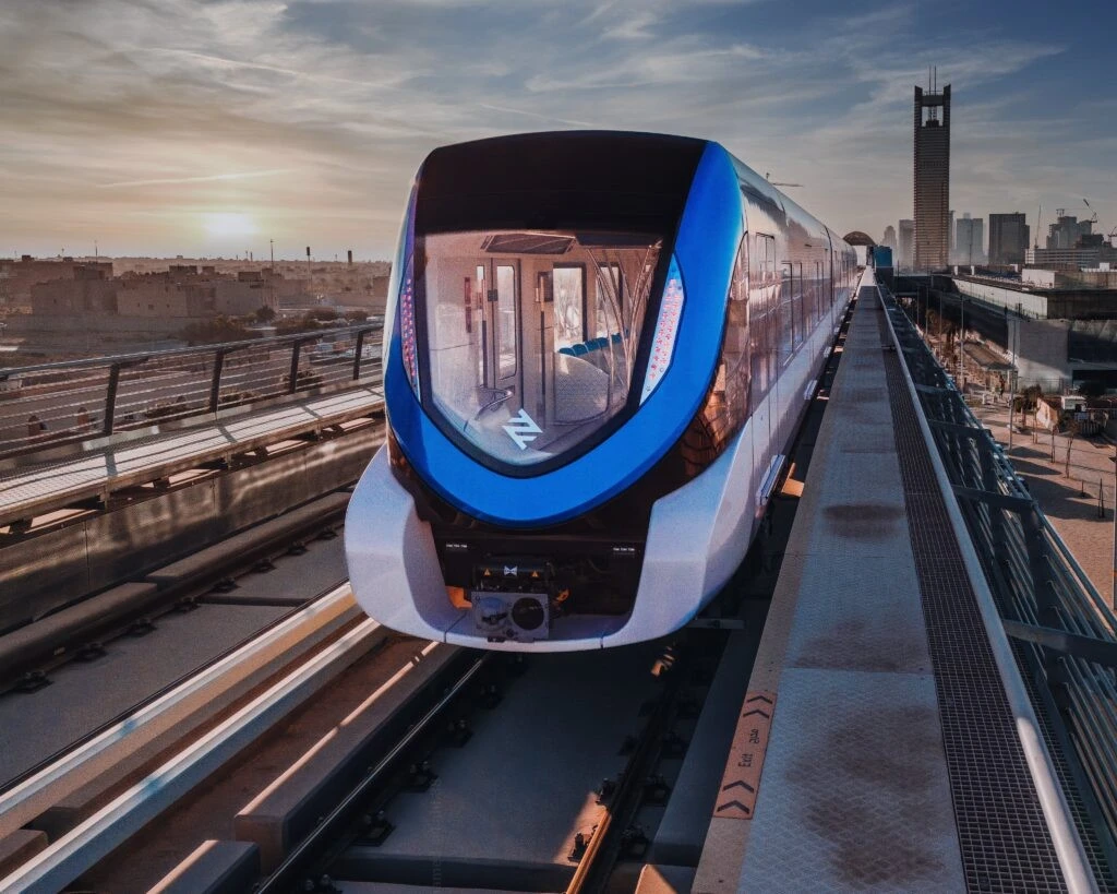
The entire network functions under a Grade of Automation 4 (GoA4) model of train — the highest level of rail automation — where all services run on a fully automated, driverless basis. This type of train service is as commonly referred to as Unattended Train Operation (UTO). This autonomous operation is managed and monitored with high precision from central control rooms, ensuring peak efficiency, reliability, and safety standards are maintained across the capital.
The network is designed to link all parts of the city, connecting densely populated districts, major commercial centres, key government institutions, and prominent landmarks such as the King Abdullah Financial District (KAFD) and King Khalid International Airport (KKIA). The project aims to reduce traffic congestion and enhance mobility across the Saudi capital, supporting the city's urban and economic development goals under Saudi Vision 2030.
You Might Like: Can you guess which Riyadh Metro line is the busiest route?
The Riyadh Metro network is vast, comprising six integrated lines that collectively cover 176 kilometres (109 miles) and serve 85 stations. This makes it the longest fully driverless train network in the world, a title that is now officially certified by Guinness World Records.
The six colour-coded lines are:
- Blue Line (Line 1): Al Olaya – Al Batha Axis (38 km)
- Red Line (Line 2): King Abdullah Road Axis (25.3 km)
- Orange Line (Line 3): Al-Madinah Al-Munawwarah Road Axis (40.7 km)
- Yellow Line (Line 4): King Khalid International Airport Axis (29.6 km)
- Green Line (Line 5): King Abdulaziz Road Axis (12.9 km)
- Purple Line (Line 6): Abdulrahman Bin Auf Road Axis (29.9 km)
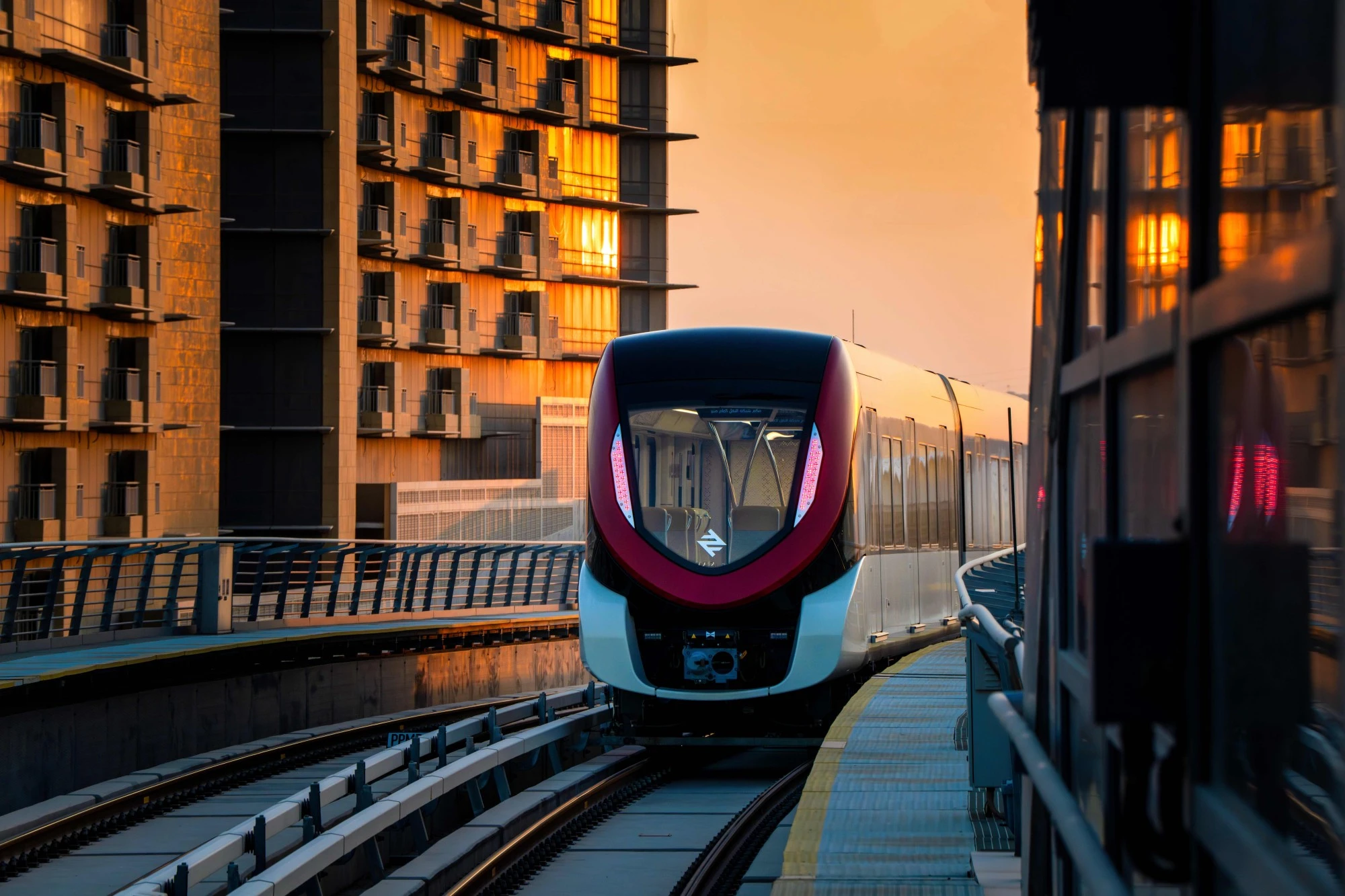
The Blue Line (Line 1) has emerged as the most popular route in the Riyadh Metro network; this line runs along the Al Olaya – Al Batha Axis, extending for 38 kilometres and serving 25 stations. Its popularity is due to its route through the heart of the city, connecting major commercial and financial districts like the King Abdullah Financial District (KAFD) with the busy central areas of Al Olaya and Al Batha. The Blue Line's high usage underscores its critical role as the primary north-south artery for commuters and visitors in Riyadh.
Check out the full details of the record here
@rcrcsa
@guinnessworldrecords