


A city of contrasts, the Copernicus Sentinel-2 mission offers a unique bird's-eye view of Riyadh.
Riyadh is the bustling capital of Saudi Arabia, and this image taken by Copernicus Sentinel-2C is a high-resolution image revealing the city's intricate and well-planned urban layout, sprawling city limits and growing infrastructure, in addition to the natural surroundings and purpose-built greenspaces.
Captured on September 14, 2024 by the Copernicus Sentinel-2 more than 780 kilometres above Earth, the image provides us with a glimpse into the dynamic and rapidly evolving city of Riyadh.
What can we see?
Riyadh's distinctive grid-like street pattern is clear to see, and is formed by square city-planned blocks of buildings measuring approximately two kilometres on each side. The city's commitment to urban planning is evident in this well-organised layout.
Amidst the concrete jungle, the Sand Sports Park stands out with its flower-like construction. This massive project, part of the Sports Boulevard initiative, covers over 17 million square meters and will feature a variety of sports facilities, cycling paths, and entertainment venues.
King Khalid International Airport, located approximately 35 kilometres north of the city, is also visible in the top left corner of the image. This major transportation hub serves as a gateway for millions to Saudi Arabia, and to the nation's seasonal celebration Riyadh Season, and with numerous new flight routes regularly announced, the airport continues connecting the capital city to the rest of the world.
The southern part of the city showcases Riyadh's industrial side, with its numerous factories and warehouses. The bright white rooftops of these buildings stand out against the sandy terrain, highlighting the city's economic vitality.
With its ambitious infrastructure and green space projects, thriving economy, and rich cultural heritage, Riyadh continues to solidify its position as a leading city in the Middle East.
About Copernicus Sentinel
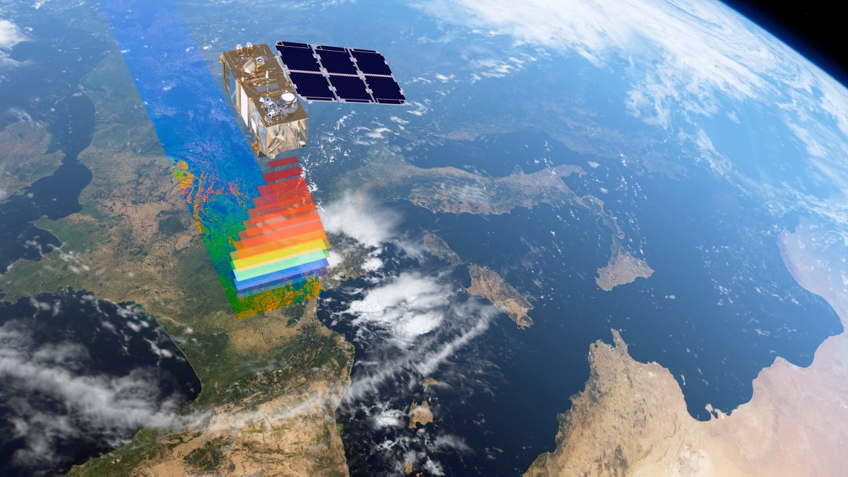
The Copernicus Sentinel-2C satellite was successfully launched into the stratosphere on September 5, 2024, from Europe's Spaceport in French Guiana aboard the final Vega rocket.
According to the European Space Agency website, "The Sentinel-2 mission is part of Copernicus – the Earth observation component of the European Union’s Space programme."
This new edition, joined its twin satellites, Sentinel-2A and Sentinel-2B. However, in contrast to the previous editions, Sentinel-2C is now equipped to capture high-resolution images of Earth's land, islands, and coastal waters from its orbit of 786 kilometres.
Images of other locations that have been released so far of Los Angeles in California, the coastline of Belize in Central America, Camargue and Montpellier in the south of France and Seville, the capital of Andalusia in Spain.


